Sagaing Fault
Published on 11 Oct 2025
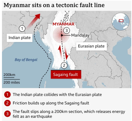
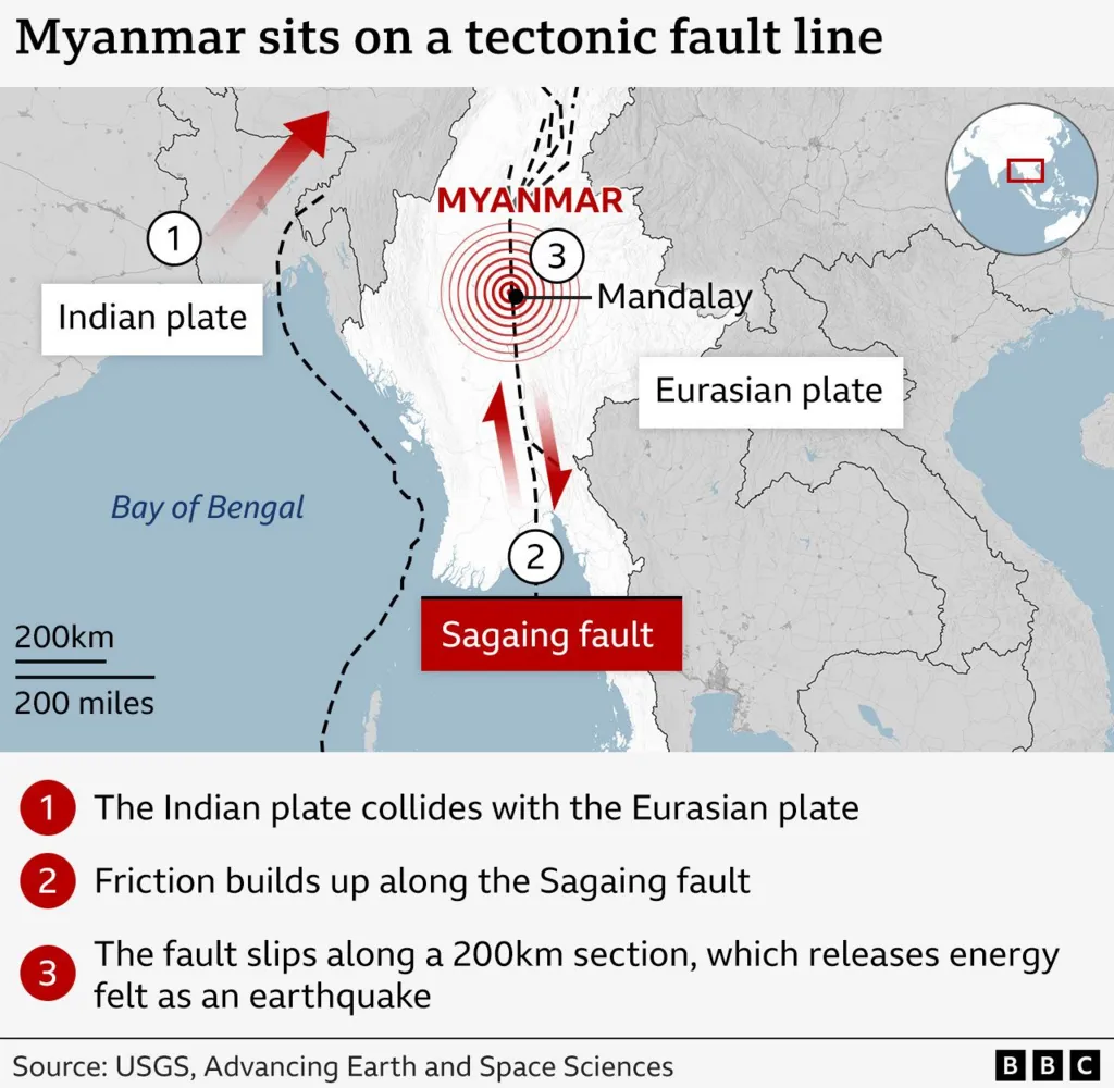
The recent earthquake in Myanmar had its source in central Myanmar, about 20 km from Mandalay, the country’s second-largest city.
Mandalay, located on the east bank of the Irrawaddy river, is close to one of the most seismically active faults in the region, called the Sagaing fault, named after a town not far from Mandalay on the river’s opposite side.
The north-south running Sagaing fault forms the tectonic boundary between the Central Myanmar Lowlands and the Indo-Burman Range.
An elongated micro-tectonic block that exists between the Indian plate and the Sagaing fault is commonly called the Burma plate or the Burma Sliver.
It owes its origin to the strain partitioning occurring at the subduction front.
Unlike the vertical motions of fault blocks along the frontal part of the convergence zone, where one tectonic block is pushed up on the other, the movement is horizontal on the Sagaing fault, with the blocks sliding past each other.
The San Andreas fault in the western U.S. is another such example.
Classified as a typical ridge-trench transform fault, the Sagaing fault system runs 1,400 km between the spreading centre under the Andaman Sea in the south to the eastern Himalayan bend in the north.
Note: Operation Brahma: India launched Operation Brahma to provide necessary support, including Search and Rescue (SAR), humanitarian aid, disaster relief and medical assistance, following the devastating earthquake that struck Myanmar.
https://ichef.bbci.co.uk/news/1024/cpsprodpb/1f47/live/c165b580-0ca9-11f0-ac9f-c37d6fd89579.jpg.webp
Keywords:
Sagaing Fault
Faulting
Folding
earthquake
Geomorphology
Myanmar
Indo-Burman
Burma plate
Plate tectonics
converging plate
Diverging plate
Operation Brahma
Indian Plate
Eurasian plate
Prelims Current Affairs
Brown Trout
Bonnet Macaques
New Aspergillus Species Discovered in Western Ghats
Mains Current Affairs
Ragging in Campus
Time Use Survey 2024
Amir Khusrau and Persian Influence in Indian Culture